-
Archives
- June 2015
- May 2015
- March 2015
- January 2015
- December 2014
- November 2014
- October 2014
- August 2014
- July 2014
- June 2014
- May 2014
- April 2014
- March 2014
- February 2014
- January 2014
- December 2013
- November 2013
- October 2013
- September 2013
- August 2013
- July 2013
- June 2013
- May 2013
- April 2013
- March 2013
- February 2013
- January 2013
- December 2012
- November 2012
- October 2012
- August 2012
- July 2012
- June 2012
- May 2012
- April 2012
- March 2012
- February 2012
- January 2012
- December 2011
- November 2011
- October 2011
- September 2011
- August 2011
- July 2011
- June 2011
- May 2011
- April 2011
- March 2011
- February 2011
- January 2011
- December 2010
- November 2010
- October 2010
- September 2010
- August 2010
- July 2010
- June 2010
- May 2010
- April 2010
- March 2010
- February 2010
- January 2010
- December 2009
- November 2009
- October 2009
-
Meta
COMMONWEALTH AVENUE: Grand Boulevard, Dangerous Street
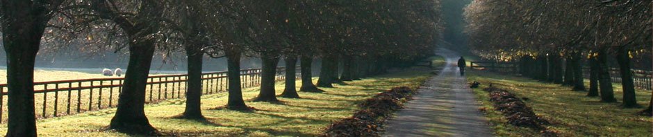
Stretching from the Public Garden out to Weston, Commonwealth Avenue meanders past sculptured medians, historic parks, heartbreaking hills, ponds and rivers, and an enormous number of residences and businesses. Although various crossings are frustratingly congested, in general the number of cars has been steadily dropping while the number of trolley passengers, bicyclists, pedestrians, and runners has been steadily increasing. The busiest sections are the least fancy: the Mass Ave. crossing, Kenmore Square and the BU corridor, Packards corner to around Warren Street. The BU bridge area is the thickest of all with huge numbers of rushing students, growing cohorts of cyclists, and frustrated car drivers trying to squeeze through the spaghetti mess from Longwood Medical Area to Storrow or (via Cambridge) the Mass Pike. Much of the rest of Comm Ave has relatively light (and therefore, because of the invitingly wide lanes, fast) car traffic.
Comm. Ave has been undergoing periodic renovations and re-inventions almost from the day the first luxurious Back Bay section was built in the mid-1800s. The straight Kenmore to Packards Corner section came later in the century and the curvy section up to the elegant Chestnut Hill Reservoir came near the end of the 1800s based on a landscaped Olmsted design, eventually linking up with a fancy boulevard in Newton. In the early 1900s the street cars were added to promote development, today’s Green Line. And from the 1950s onward an increasing amount of the huge width has been devoted to cars – moving, turning, and parking (as well as purchasing, fixing, refueling). In the words of Allston activist, Matt Danish, (drawing on the writings of Bill Marchione published at http://bahistory.org) the city made the road more car friendly by “cutting down more trees and laying asphalt over even more portions of the remaining grass mall. Large parking areas were created near Harvard Ave, taking the place of much of the remaining parkland. At Warren Street, an entirely new motorway was cut into the grassy side of the hill, and westbound traffic diverted across the tracks at a strange angle that persists to this day: as anyone familiar with that intersection can attest. Later, a fence was erected down the middle of the MBTA reservation, literally splitting the Allston community in two.”
Each of the changes set the tone of the Avenue for decades afterwards. Today, we’re just emerging from the “let’s make it a highway” epoch. What comes next will help define not only this historic corridor but the Walsh Administration’s transportation vision and the relationship they see between roads and the kind of city Boston will become.
PLANNING FOR THE COMING ERA
Commonwealth Ave’s current transition started a few years ago and will take much of the next decade. The challenge facing city and state transportation planners is predicting the pattern of future use based on past patterns, current trends, and the effect of policies pushing us away from past patterns towards a more desirable future. Nationally, despite localized congestion, urban car usage has been dropping since even before the economic recession and isn’t rebounding as much as predicted now that the economy is doing better. In fact, for a variety of reasons, a very high percentage of official traffic predictions done for road projects over the past half-century have turned out to over-estimate the number of cars that roads actually serve. At the same time, nearly every transit and bike project in recent years has resulting in a significant (sometimes huge) release of “latent demand” and surging usage that often outstrips official predictions. Are these lessons that should be carried into the Comm Ave project? Will car traffic continue to decline in this area over the next several decades? Will trolley use and bicycling continue to grow? Will there be more or fewer late-to-class BU students rushing across intersections? Will there continue to be a couple of intersections where cars crossing the Avenue get seriously backed up?
In addition to usage-trend analyses, traffic planners have to deal with new understandings about ways the road can be made the safest and most efficient possible for every user no matter what their age, ability, or mode of travel. Contemporary ideas reject the post-WWII era’s tendency to apply highway lessons to city streets. Rather than being seen as safety improvements, arterials with wide lanes, long light cycles, “soft” curves and corners, and few side-of-road distractions are now seen as the cause of accidents. In a near total reversal, current best practice is to slow cars down by narrowing lanes, tightening turns, shortening light cycles, and creating conditions that keep driver’s paying attention to their surroundings. Instead of letting cars “race to the next red light”, today’s planners know that reducing travel-time through a stretch of road is best accomplished through better signal timing. The slow-but-steady strategy of maintaining throughput is exemplified by Cambridge’s success in moving traffic through Central Square while adding bike lanes, more crosswalks and bus stops, and cutting the number of car lanes in half.
Instead of treating pedestrians as a problem, today’s planners see them as a vital part of the street scene and prioritize their comfort with wider sidewalks, narrower crossings both at corners and mid-block, and shorter walk-signal wait times. Instead of ripping up trolley tracks and overhead wires, cities are now installing new train, light rail, and bus rapid transit routes.
And the amazing rebirth of bicycling as an effective urban transport method has forced an unprecedented rapid evolution in bike facilities. The existing “standard” bikes lanes, while an improvement from the nothing that preceded them, are clearly not enough. State-of-art design has moved from painted lines a few feet out from parked cars to protected bike lanes separated from both traffic and opening doors by curbs, green space, flexible bollards, or stripped buffers.
Finally, planners have to incorporate the implications of city and state policies to promote climate-change resilience by reducing greenhouse gas and other polluting air and water emissions, increasing transit and non-motorized travel, and improving our storm-water handling capability. Fortunately, the way to realize these goals overlaps with the new safety understandings AND the probable answers to the usage-trends questions: prioritize transit, pedestrians, and bicycling; slow cars while maintaining a slow-but-steady through put.
Ultimately, Commonwealth Ave., like most road projects, is not really a transportation planning problem. It’s a city planning problem. What’s needed is a vision of how we – led by the new Mayoral Administration – want the areas alongside the road to develop over the coming years and then we have to design the road to help move us towards that future. The question is if Boston’s transportation planners also see it that way.
PHASE 2A: Amory to Alcorn Streets (BU Bridge to Packards Corner)
Commonwealth Avenue’s problems are nothing new. There used to be annual car crashes in the crazy intersection in the middle of the BU campus, next to the BU Bridge. Local people remember hearing about plans as far back as the 1980s and 90s. Comm. Ave. is one of the city’s busiest and – along with Mass Ave. – most dangerous corridors. Some of the pedestrian crossings in this area are notorious: a couple years ago LivableStreets timed the lights around the BU Bridge and found that it would take someone who actually obeyed the walk signals nearly 4 minutes to cross the street.
Two years ago, after a horrible run-over death of BU student cyclist Christopher Weigl, the Boston Transportation Department installed better bike lane markings and other improvements. But, unfortunately, these don’t seem to be enough: vehicle-bike accidents seem to continue happening at alarming frequency and the death count has tripled. According to the Boston Cyclists Union, “the 7-block stretch of the street from Packard’s Corner to the BU Bridge has hosted more bike crashes than any other similar stretch of road in the city…[with] 68 crashes between 2009 and 2012….A recent study by a student at Northeastern University has shown that 45 percent of cyclists who use the existing bike lane are actually forced out of it by illegally parked cars.”
This heavily used stretch, from Amory Street to Alcorn Street, is designated Phase 2A and is currently being designed under the control of the Boston Transportation Department (BTD). Several years ago, to help cover the costs of this effort, BU paid Tetra Tech, a huge construction and transportation consulting firm to prepare a design. The Tectra Tech proposals were car-centric and significantly behind the times in terms of non-car facilities. Most notably, the design lacked the components that most pedestrian, transit, and bike Advocates think are needed: physically separated cycle tracks (rather than bike lanes), wider sidewalks (the plan actually proposed to narrow sidewalks), additional and improved crossings (especially around the Star Market and Babcock T crossing), and traffic-calming narrower lanes and sharper turns (the plan called for wider car lanes and “softer” turns) – not to mention the cutting down of mature trees and limitations on sidewalk cafes. (These last problems are exacerbated by the MBTA’s refusal to coordinate its own upgrading plans with the city’s street renovation, resulting in at least two years of street closures rather than one.)
Unfortunately, the Boston Transportation Department (BTD) used the original Tetra Tech plan as a starting point. For some reason, BTD then proceeded to ignore the public-input protocols that it had been developing in recent years. There was no “concept-stage” opportunity for suggestions, no 25%-of-design-completion public meeting, a total lack of response to the written suggestions advocates managed to send in after realizing that plans were being rushed towards completion, and so far no 75%-of-design-completion public meeting either.
In addition, BU Vice President Robert Donahue has warned that access to the federal earmark funding that is needed to pay for the actual construction might disappear if a redesign delays the work until after September 2015. However, community advocates point out that road projects are often delayed and if all the interested parties were to agree it is not unusual for appropriated funding to be maintained until needed – especially if safety were the driving motivation. And given the massive disruption of Comm Ave that will be caused by the need to completely shut down the road in 2016 in order to fix the BU Bridge intersections (see below), it would make sense to reduce costs and negative impacts by doing the Bridge-to-Packards Corner work at that time too.
In addition, working in support of the student-led BU Bikes Group and a number of BU Faculty, a coalition of transportation advocacy groups – Boston Cyclists Union, LivableStreets Alliance, WalkBoston, and MassBike – have come up with a united vision of how to include improvements for trolley passengers, pedestrians, bicyclists, and cars. It is no longer possible to claim that “it can’t be done.”
Fortunately, it appears that growing public pressure has convinced BTD leadership to make some improvements, although even those are complicated by lack of coordination with MBTA plans to upgrade and consolidate its Green Line trolley stops in the area to comply with ADA regulations. Still, at a public meeting called by BU Students nearly every speaker described the dangers they face using the current bike lanes and demanded a separated bike facility. Acting BTD Commissioner Jim Gillooly said that “the one decision you can take to the bank is…there will be significant improvement, if not dramatic improvement,” from the original reconstruction plans that drew cyclists’ criticism earlier this summer. So it’s possible that there will be more than token change in the final design.
COMING PHASES: 1-2B-5
Phase 1 of the Comm Ave work covered the area from Kenmore Square to the BU Bridge. Those designs, too, originally lacked any bicycle facilities and were weak on pedestrian improvements – the bus stop near the Bridge makes the sidewalk dangerously narrow. As one of the founding actions of LivableStreets Alliance, enough pressure was put on Boston’s Transportation Department to force the inclusion of rudimentary bicycle lanes. This victory was followed by LivableStreets’ Better Bridges campaign that won bike lanes on the BU Bridge itself despite opposition from BU’s Administration and the other elephant-in-the-room – institutional giant MASCO which serves the economically powerful Longwood Medical Area (LMA), many of whose car-commuting employees use the BU bridge on their way north. (While the Bridge itself seems to work fine with the new lanes, back-ups continue to be caused by the insanity of the CommAve/Mountfort/Carlton Street spaghetti and the Cambridge-side rotary.)
Phase 2B focuses on the MassPike Overpass that supports the Comm Ave pavement in front of the BU Bridge. The foundational structure is currently being repaired, causing huge complaints from delayed MassPike drivers. Over the next couple years designs for the entire intersection will be developed. Advocates believe that a lot of the current complexity, caused by forcing north-bound traffic to go down Carleton and then across Comm Ave – creating two stopping points and messing up the entry-process to Storrow Drive as well as the safety of students walking near the bridge — would be eliminated by allowing cars to continue straight along Mountfort. However, MassDOT claims that the island at the end of Lenox Street that currently prevents this traffic pattern is too far away from the MassPike overpass for improvements to be paid for with the toll money being used for the rest of the intersection. And Boston’s people point out that the island actually lies in Brookline. So unless the multi-jurisdictional issues can be resolved the traffic jams are likely to continue.
Even worse, keeping the current snake-curving route allows BU and MASCO to argue for adding a second right-turn lane from Comm Ave on to the bridge, adding a car lane for cars coming off the bridge, and adding a car lane for cars coming into the intersection from the eastern (Kenmore Square) side even though this lane will disappear on the other side of the bridge. Adding this space for cars leaves no room for wider sidewalks, or improvements to the University Road crossing, or a median safety zone for pedestrians unable to cross the entire width of Comm Ave in one run, or for improvements (required by the inadequacies of Phase 1 designs) to the uncomfortable and traffic-blocking bus stop near the Bridge.
But all this is a fight-to-come. As are plans beyond the initial landscaping for Phase 5, covering the area from Washington Street to the Newton line.
ON THE TABLE: PHASE 3 & 4
However, already on the table are plans for the upcoming Phases 3 and 4, covering Packards Corner to Warren/Kelton Street under the direction of Boston’s Department of Public Works. Traffic is light: the six lanes of Comm Ave carry about a third fewer cars than the 2-lane Harvard Ave nearby. While work on this area is still in the conceptual stage, and is already hampered by the MBTA’s unwillingness to even discuss the possibility of moving the trolley tracks to a less exposed part of the nearly 200’-wide right of way corridor, the Agency’s leaders and consultants (HDR Inc) have already incorporated many good ideas and seem open to discussions about doing even more. Included in the conceptual plans are road and lane diets to slow traffic and create room for ped/bike facilities, “neck down” curb extensions to shorten the distance walkers have to travel across intersections, using the adjoining “carriage lanes” as shared space, wider sidewalks and bus access areas, more open space at Harvard Avenue, and protected bicycle lanes or cycle tracks.
A recent letter from Allston residents and advocates listed their hopes, which parallel the hopes that BU students’ have for the preceding Phases: better trolley facilities and passengers’ desire-line access, more green space and trees, protected bike facilities and intersections in accordance with the city’s Bicycle Network Plan, remove the median fence and make pedestrian crossings no more than 350 apart, give trolleys signal priority, restore the green links that once existed all the way to Chestnut Hill Reservoir – as well as a public open space at the Harvard Ave intersection and improved Malvern Street access to the future West Station going in to the revised I-90 tollbooth area.
Of course, the ultimate proof of the city’s good intensions will be shown in the pavement actually laid down, and there’s a long way to go before good ideas turn into facts on the ground.
———-
Thanks to Matt Danish, Jeff Rosenblum, and Pete Stidman for comments on previous drafts. The opinions are, of course, entirely my own responsibility.
—————–
Related previous postings include:
> WALSH ADMINISTRATION NEEDS A TRANSPORTATION MAP: Which Way On Comm. Ave. Design?
> FROM BETTER TO WORSE ON COMMONWEALTH AVE: City Leaders Need To Step Up For Their Own Policies
> MOVING BEYOND CAR LEVEL OF SERVICE (LOS): Measurable and Meaningful Criteria for Transportation Investments, Project Designs, and Development Mitigation (revised)
> SLOWING TRAFFIC TO A TARGET SPEED: How To Make Our Streets Safer
This entry was posted in Commentary & Analysis, Road Design, ROAD DESIGN AND MODE CHANGE, Safety. Bookmark the permalink.
