On behalf of LivableStreets Alliance, I have been participating in a 45-person Task Force representing a wide range of interests assembled by MassDOT to make suggestions on the design for the Longfellow deck surface. MassDOT will submit these ideas, along with its own analysis of which should be the “priority alternative,” to the Federal Highway Administration for review. Unfortunately, the bridge is not wide enough to include the entire list of facilities desired by pedestrian, bicyclist, car, and transit advocates – so the challenge is how to best divide up the burden of limited space among the various modes. The following is based on comments I made at the public meeting held near the end of the Task Force process.
1) The goal is to create a bridge that is accessible to all users, no matter their level of physical ability or mode of travel, and that is well connected to the surrounding neighborhoods and the adjacent parklands.
2) We need to lock in the many things that (almost) all Task Force members agree on:
3) Reducing car speed is critical for safety and functionality.
4) The location of crash barrier is the one unalterable and therefore crucial decision.
5) Six years of construction all along the Charles River basin will radically change travel patterns.
6) We need “world class” pedestrian and bicycle facilities.
7) The “truth” is at the “pinch points.”
1) The goal is to create a bridge that is accessible to all users, no matter their level of physical ability or mode of travel, and that is well connected to the surrounding neighborhoods and the adjacent parklands.
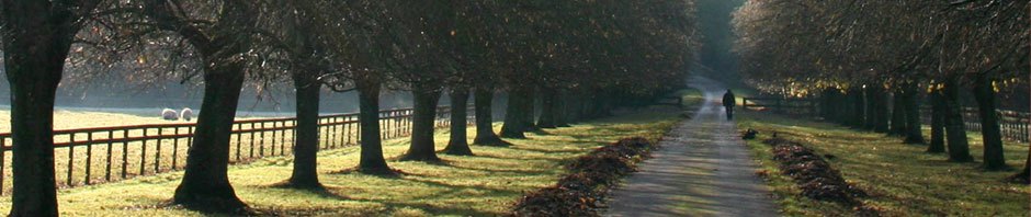
We need to be bold, visionary, and flexible to be prepared for a future that, while still unknown, is likely to require our transportation system to operate under very different conditions than it has for the past 50 years. It is likely that fuel costs will be higher, pollution regulation stricter, and cars smaller, with a larger number of people taking the T, riding bikes, walking, or perhaps using electric vehicles. In addition, the Longfellow is a place in itself, not merely a passageway between two towns: we need to honor its history while making it a destination able to welcome those who want to sit, think, and look over one of the best views in the region.
2) We need to lock in the many things that (almost) all Task Force members agree on:
Facilities for pedestrians and cyclists have to be significantly improved both on the bridge and in the areas leading on to and off of the bridge, as well as from the bridge area to the river: Adding pedestrian and bike road markings, signs and signals both on the Cambridge side and around Charles Circle as well as tightening all the corners and narrowing the ramps to/from Storrow & Memorial Drive to one lane; making it easier and more inviting to get from the upstream side to the downstream sides of the bridge and improving access to the river parkland/paths on both the Cambridge and Boston sides; installing a traffic light at Blossom Street – at least on the east-bound side of Storrow.
There is no need for more than one lane of general traffic on the outbound (Cambridge-bound) side (partly because it is so much easier to exit the bridge into Cambridge than into Charles Circle). Truck and bus traffic are less than 2% of the Longfellow total. Traffic lanes 10’6” wide can handle this – making them the same or wider than the lanes being planned for several other Charles River bridges and local streets that also care bus and truck traffic.
The MBTA reservation should stay at 27’.
3) Reducing car speed is critical for safety and functionality.
The bridge is a city street, not a highway. It emerges from the confusion of Kendal Square and ends in the chaos of Charles Circle – there is no need for cars to be able to go 45 or 50 (or more) mph over the water. MassDOT will be posting a 30 mph legal limit (which we’d prefer to be set at 25 mph or even 20 mph), but the real issue is the highest speed at which drivers feel safe and comfortable – the “design speed.” MassDOT says the bridge will be designed to handle speeds up to 60 mph. This is simply unacceptable. We need the bridge to be structurally designed to limit driver’s comfort to no more than 35 mph through narrow traffic lanes (10’6” or less), rumble strips, speed indicators, signage, and other methods.
4) The location of crash barrier is the one unalterable and therefore crucial decision.
The bridge deck can always be repainted to change lane width and locations. But once the crash barrier is installed as part of the core structure, it stays put. MassDOT has said they need to have between 19’ and 24’ of accessible pavement for emergency use. We believe the crash barriers on both the outbound and inbound sides should be placed so that there is about 22’ or 23’ of accessible pavement between it and the MBTA reservation. This will provide the widest possible promenade space between the crash barrier and the outside railing.
(We understand that this has implications for the roadway layout – in particular, that the right-most (outside) lane will be painted as a buffered bikeway in the mid-span, which is not an issue on the outbound/downstream side but is still controversial on the inbound/upstream side. If the alternative layout of two traffic lanes and a separated bike lane are included on the inside of the crash barrier, the barrier will have to be further out and the potential promenade area will have to be narrower.)
5) Six years of construction all along the Charles River basin will radically change travel patterns.
Because people are smart and constantly adjusting their behavior to meet changing circumstances, there will inevitably be less car traffic over the bridge during the many years of construction disruption. (Experience in cities all around the world show that reducing overall car capacity does NOT simply lead to a redistribution of car traffic – it also leads to people changing how and when and to where they travel. The “water” does not just “flow elsewhere,” it “evaporates” into a different form.) This is on top of the already existing trend that has seen total car volume decreasing across the Charles River bridges in recent years while the number of pedestrians and cyclists has been rapidly increasing.
Therefore, we have to decide if we will create a bridge design layout that takes advantage of this reduced demand, or one that tries to re-attract more cars back to the bridge. We believe we have a unique opportunity to unleash the existing but latent demand for walking and cycling without encouraging people to start using their cars again – as with highways, we know that “if you build it, they will come.”
6) We need “world class” pedestrian and bicycle facilities.
There should be comfortable and inviting entry-ways for pedestrians and cyclists on both sides of the bridge. Meeting minimal standards is not good enough. The sidewalk should never be less than 8’ wide and more like a 10’ to 15’ promenade in the mid-span (meaning “clear space” rather than “total including railing and crash barrier). The cycling space should always be buffered from car traffic and at least wide enough over most of the bridge for a faster person to pass a slower one – especially in the uphill areas.
7) The “truth” is at the “pinch points.”
All the currently shown alternatives – even those that include pushing out the bridge railing on the inbound side from the Storrow median to the last “salt shaker, and pushing out the stone wall from there to Charles Circle – do not allow adequate or safe pedestrian and bicycle facilities along the narrower “pinch points.” Even if the proposed new pedestrian path alongside the bridge is perfectly designed, allowing the bike lane to grow a bit before it opens into a “bike box” at the traffic light, this will only relieve the tightness for a small stretch right in front of Charles Circle – most of the pinch point problem will remain. The only way to not force walkers and cyclists to suffer the majority of the burden of the narrow space is to have no more than 2 lanes of car traffic entering the Circle (which is all that a lot of us believe the Circle can comfortably handle in any case) or to make the 3 lanes desired by MassDOT extremely narrow – perhaps no more than the 9’ they currently are.
