If you build it, they will come. Given the starting assumptions, Boston planners have come up with an excellent design for the reconstruction of Melnea Cass Boulevard in lower Roxbury. It is a layout worthy of the Urban Ring vision that inspired it.
Unfortunately, the assumptions are flawed and, therefore, so is the proposed design. The Field of Dreams magic doesn’t work if you only build half a baseball field. And building a short stretch of roadway won’t bring Bus Rapid Transit (BRT) service, or any other kind of public transportation, if there are no plans to build the rest of the system. Melnea Cass Boulevard needs improvements that will promote economic development, reknit the abutting neighborhoods, and facilitate alternatives to car traffic. Money is available, up to $9.5 million, using state and city funds to supplement a $5.5 million earmark Congressman Capuano inserted in a federal bill. But for all the still-needed functionality of a city-encircling transit system, an Urban Ring to complement our mostly in-and-out commuter lines, the city’s currently proposed design – which will create a 0.9-mile segment of the long-planned Bus Rapid Transit network – will serve neither the still-needed Urban ring nor the through-rushing car commuters, nor the adjacent neighborhoods.
The critical component of the proposed redesign is the insertion of two additional lanes for eventual use by BRT buses, and until then as a “priority lane” by emergency vehicles and various buses that use all or part of Melnea Cass – although the temptation to allow cars might be hard to resist. Because a “transit reserve” was created along the road after the BRA wiped out the residential neighborhood in the 1960s, no private property needs to be taken for the project, which will simply occupy the existing “right of way.” However, even though the official term for the project is “reconstruction” the reality is that the new design is a dramatic, 40-foot widening of the asphalt.
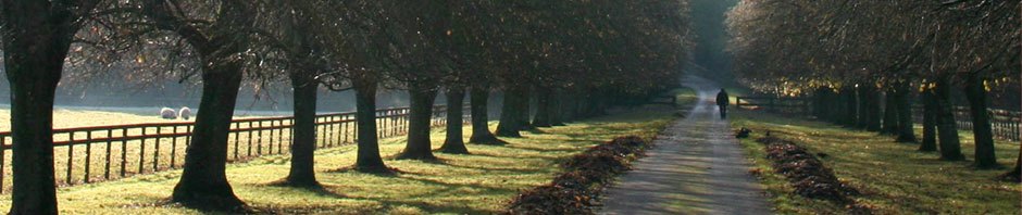
The required 40-foot expansion of the road will create a longer, 108-foot crossing for pedestrians (similar to Beacon Street at Coolidge Corner) mitigated by a mid-passage pedestrian island. It would remove up to 40 feet of grass and trees from most of the Lower Roxbury (northeast) side, as well as trees and planting adjacent to the townhouses on the Madison Park (southwest) side of the Boulevard. The 200 mature trees to be eliminated would be replaced by 300 (admittedly less attractive or shady) young saplings and a storm-water-handling bio-swale.
There will be 8’ sidewalks on both sides of the boulevard with a two-way bike path on the in-land side. On-street parking will be added along several blocks to both support future retail shops and calm currently fast traffic. At key intersections, left-turning lanes will eliminate a major cause of wait times and backed-up congestion.
However, most of these improvements could be done without adding the two lanes, the component that has sparked intense community opposition. The “Friends and Neighbors of Melnea Cass Boulevard” would like to see traffic speed reduced through retiming the traffic lights for a 20 mph signal progression through the Boulevard, longer walk signal duration with raised cross-walks, and improved bike path (on both sides of the road, as planned in the Roxbury Strategic Master Plan) connections with the Southwest Corridor path and the South Bay Harbor Trail to make an inviting connection to downtown. (While pedestrian connections are vital, bicycling is better for weight control because most people walk too slowly to impact calorie accumulation.) The community groups also support better bus service throughout the area on both Key and Regular route as described in the Roxbury/Dorchester/Mattapan Transportation Improvements Study.
The community critics are correct in pointing out that it is hard to show that the current design will achieve any of the Melnea Cass Project’s own goals to “return the street to the neighborhood”, “create a street for the community rather than for vehicle traffic passing through”, “enhance pedestrian safety”, and “encourage activity/create attractive front yards for new developments.”
———————————-
CREATING LINKS IN A FUTURE CHAIN
There is a good precedent for including BRT lanes in even this short segment of the future route. About thirty years ago the Boston Harbor Association began demanding that developers include a wide water-front path on their property along with an easement allowing public access. For years, developers complained of the expense and lost space, accurately pointing out that there was just impassible junk on either side of them. But BHA President Vivian Li said that public access would be constructed piece by piece and this segment was not going to be allowed to end up as the missing link. She was right – several decades later the Boston Harbor Walk has emerged as a fabulous public facility (although not always bicycle accessible), still growing towards an eventual 46 miles from Chelsea Creek to the Neponset River.
The problem is that baring gargantuan changes in state plans and public financing, the Urban Ring is not going to happen. Its cost and complexity have convinced state leaders to focus on other projects. Thirty years from now, the metro region will look back and regret this decision. And, in a technical sense, the Urban Ring isn’t totally dead, if only because the logic for its creation is so strong. Like the North Station to South Station Rail Connector, the Urban Ring has become a zombie, not really alive but still waving its arms for attention. But making it even less alive is that the city has no plans to continue the bus lanes east of Albany Street or west of Ruggles Station, and fully developed BRT facilities are not included the new plans for Dudley Square. And the Ring’s exclusion from the state’s new 2030 Transportation Plan means that it is not eligible for most federal funding programs such as New Starts.
NOT EVERY GOOD IDEA ACTUALLY HELPS
Community critics of the expansion plans ask, “If the BRT lanes weren’t included elsewhere, why do it here?” If dedicated bus lanes ever become necessary, why not simply use two of the existing car lanes? The “Friends and Neighbors of Melnea Cass Boulevard” point out that the turning lanes, traffic light timing improvements, and other traffic-flow changes will eliminate most current delays, for both cars and buses, on the Boulevard even without the new lanes. Projections of future gridlock are based on traffic-growth assumptions and models that were inaccurate when used in the past to predict current traffic volumes and are almost certainly inaccurate in their prediction of future disaster – even with the business expansion that the neighborhood hopes to continue to attract. The expanded asphalt surface area, the loss of trees, and the additional traffic the wider road will attract will inevitably increase noise, dust, air pollution, and rising temperatures. In any case, the worst intersection in the entire area is at Massachusetts Avenue, with the Southeast Expressway exit and entrances exploding into Roxbury – but the current proposals explicitly do nothing about this bottleneck.
The critics are right. The city and the surrounding community would be best served if the city and state made these easier changes as well as fixed the sidewalks, expanded and repaired the off-road bike paths to allow travel on both sides of the road, and improved the lighting and landscaping. Melnea Cass Boulevard is already wide. But the friendliness and economic vitality of a street is less dependent on its width than on the nature of what surrounds it – the best combination includes short blocks with a variety of retail stores, plenty of green, comfortable places to sit or stand and talk with friends, adequate transit and ped/bike facilities, mid-block crossings on the longer stretches, slower traffic, and a feeling of separation from faster moving traffic.
Money is not always fungible – the earmark and other funds have to be spent on the road and associated tasks. But the extra lanes are not a precondition, and the city would be wise to let this particular dream go.
FROM HIGHWAY TO TRANSIT
The Melnea Cass Boulevard story goes back to the plan to crisscross Boston and nearby towns with highways. The Inner Belt, I-695 and various extensions, would have ripped through what were then mostly working class neighborhoods in Somerville, Cambridge, the South End, Roxbury, and Jamaica Plain – including along what is now Melnea Cass Boulevard.
Aggressive action by the Boston Redevelopment Authority led to massive destruction along huge swaths of the city – thousands of homes were knocked down leaving gapping acres of vacant land. Massive protests over more than a decade finally led to the cancellation of segment after segment of the proposed highway system by Governor Sargent in the early 1970s, leading eventually to the need for the Big Dig.
Slowly, with enormous public subsidies and direct investment (the private market doesn’t generally find low-income neighborhoods sufficiently profitable), the devastated areas began to be rebuilt and repopulated. Unfortunately, the blocks created by this process are often 500-feet or more long – double or triple what is needed for comfortable livability. And instead of highways, it was hoped that the transit system could be expanded enough to make it possible to get around the area without a car. (The economic and political driver of the project is the desperate need of the Longwood institutions for easier employee access to their traffic-congested area, combined with the competing desires of Boston University and Harvard to increase transit in their campus areas.) The Urban Ring was the vision and plan for creating a high-speed transit line circling inner ring Boston neighborhoods and communities – the northern arc going from Logan around to Wellington Circle then on to Cambridgeport, the southern arc going from Logan to Ruggles (via with extensions to U.Mass and Dudley Square), and the middle section connecting it all via Longwood Medical Area (with extensions to Allston and Harvard Square).
FROM RAIL TO BUS
Originally, the Urban Ring was going to be a trolley and/or subway project. The expense of that led to the adoption of a Bus Rapid Transit version. The 1995 creation of the three limited-stop Crosstown bus routes (CT1, CT2, CT3) were seen as a first step, to be followed by Bus Rapid Transit and rail in the most heavily used segments. However, the enormous technical difficulty and multi-billion-dollar cost of going underground in the key middle section from the BU bridge through the Medical Area led to a smart proposal by former Transportation Secretary Jim Aloisi of just completing the northern surface-level segment to Sullivan Station or even the BU bridge. But none of these proposals have survived. Currently, the Urban Ring is in suspended non-animation, no longer actively included in state planning and funding processes.
(My fellow LivableStreets Board member, Ken Kruckemeyer, former Manager of the Southwest Corridor Project in Boston, says that the same $2 billion that the two-mile Longwood tunnel would cost could pay for a five-mile underground automated transit system, including stations, all the way from Andrew Square via Longwood to Kenmore Square if the new small-bore tunneling technology used for the Copenhagen metro was adopted.)
The Urban Ring’s long-term transit vision was – and still is – a good one. But it’s unlikely that implementing the Melnea Cass segment will make it any more likely to be realized. Furthermore, neither the Complete Streets policy now guiding Boston Transportation Department road designs nor the past area-wide planning visions included in the Roxbury Strategic Master Plan require the additional lanes.
A CHANCE TO DO IT RIGHT
The Melnea Cass project is only at the 25% design stage – it’s unusual for projects to be radically changed at that point. But this should be an exception. When it comes to vision, the “Friends’” vision of “a safe, clean, pedestrian-friendly boulevard that brings our neighborhood together” is more appropriate.
——————–
Thanks for facts and/or feedback from Gene Benson, Ken Krukemeyer, Anne Lusk, Alison Pultinas, and Zara Zsido.
——————-
Related previous posts….
> BUS SYSTEM IMPROVEMENT IS KEY TO TRANSIT: Local, Improved, Express, and Bus Rapid Transit
> RECLAIMING THE LESSONS OF PAST VICTORIES: Traffic Is Not Inevitable
