This post was meant to be about three of the old highways now falling down and the increasingly bitter policy disagreements within nearby communities over what to do about it. But as I thought more about these debates, it became clear that a significant secondary theme is that so few people trust the traffic engineers or their organizations – starting with total lack of belief in the validity of the traffic prediction models being used by MassDOT. The models feel like such opaque black boxes of unknown facts and hidden formulas that they simply feel like fantasy projections of agency desires – and there is little trust of those desires either. Applauding the projections that support one’s position and denouncing the rest is neither useful, logical, nor fair. The problem is that without analysis it’s all guesswork and power plays, which is not likely to end up creating optimal outcomes either.
The distrust is so deep that people are throwing the baby out with the bathwater – refusing to accept that the models’ results have any usefulness, even in situations where they actually can help compare alternatives. The three projects each involve analysis of comparisons, and in comparison situations it doesn’t matter if the numbers are wildly inaccurate – each alternative will be distorted in the same manner giving some legitimacy to the analysis of the differences, if any, between the options. Maybe it is a local result of public disgust at the Big Dig. Maybe it’s that American culture is simply anti-government, a tendency the Tea Party car worshipers have successfully tapped. Maybe it’s that we’re in the middle of several levels of global transition from the automobile age into something else, and Transportation Departments around the world still represent so much of the archaic and destructive past practices. Whatever…. The sad result is that MassDOT’s efforts to open up the public process all the way back to the conceptual stage – at least in locations where advocates are active and vocal – have degenerated into shouting matches between the already-convinced partisans.
The danger is that we become so divided that we seem to have lost our collective ability to push past those with a stake in maintaining the car-centric past; that we end up spending hundreds of millions of dollars – and ultimately billions of dollars – recreating the roads that we already know will not carry us into a better future. Former Secretary of Transportation Jeff Mullan once said that in addition to creating one agency out of the five that were pushed together as part of transportation reform, one of MassDOT’s key challenges is regaining the trust of the public. The merger has happened. MassDOT has shown a new openness and ability to be innovative in both construction and operations, saving money while improving performance. There is, of course, more to do – perhaps finding ways to open the black box of prediction and decision-making should be next.
The Three Sisters
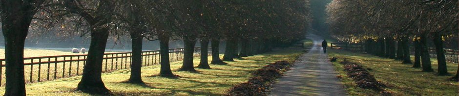
The Casey Overpass stretch of Route 203 — like Rutherford Ave. in Charlestown and the McGrath/O’Brien Highway in Somerville — is a collapsing monument to the automobile age. All three highways were built 50 to 75 years ago to connect downtown with the expanding middle-class suburbs beyond inner-ring working class neighborhoods; a function now mostly replaced by new Interstates, improved mass transit, and the re-entry of professional families into the cities. All three (and other roads built around the same time for the same purpose) have reached the end of their design life and are falling apart, with the bridge sections being the most dramatically dangerous. The fate of all three areas is linked; the dynamics of politics means that what happens to one will impact what is done with the others. Given the reduced traffic load these roads carry, the increase in bus and T lines serving roughly the same routes, and the growing numbers of people interested in bicycling and walking, the question is: what to do?
In Charlestown, the leading options are to either rehabilitate the Sullivan Square tunnel and maintain the width of Rutherford Avenue essentially “as is” in order to retain the maximum amount of car capacity, or to replace the tunnel with an “at-grade” surface intersection and turn the Avenue into a multi-modal boulevard. In Jamaica Plain/Roslindale, few want to retain the ugly and over-sized Casey Overpass so the leading options involve either recreating a smaller car-only bridge for regional commuters, or replacing the bridge with a ground-level multi-modal “greenway.” In Somerville, the McGrath decision-making process is less advanced but the leading options are to “rebuild as is,” or replace with either a boulevard or a connected series of multi-modal city streets.
Factionalized Public Debate
The city (Boston) and state (MassDOT) have conducted extensive public processes to involve residents and other stakeholders in the planning process, starting with the initial conceptual discussions. And the government agencies deserve credit for doing this, and withstanding the heated factional debates between the opposing groups. What’s surprising is who is in each group and how hard it seems for people to have calm, factual discussions about the options.
In Charlestown, the community is split. The “old guard” of traditional local leaders lean towards the car-centric approach, saying they fear that pass-through car drivers will otherwise be tempted to cut through nearby residential streets. Congressman Michael E. Capuano goes beyond that, saying that the state “should not hurt” North Shore commuters by reducing car capacity. In the “at-grade” camp are other local leaders, younger families, as well as cyclists and transit users — who seem to believe Boston Transportation Department analyses that removing the tunnel won’t noticeably increase travel times and traffic calming measures on Main Street and other key neighborhood routes will prevent people taking “short cuts.”
In some ways, the Charlestown split recreates a recent fight over the installation of bike lanes on Main Street. Last year, old guard leaders argued that any narrowing of traffic lanes or reduction of parking spaces would undermine local business and only serve the spandex yuppies who were traveling through. The sudden appearance of a large number of pro-bicycling local residents and businesses shocked the “townies” and allowed the city to continue painting the new lanes. It is likely that the traditionalists have taken on the road redesign fight not only out of anxiety over change from the car-central world they know, but also to regain their status and control against the “newcomers.”
In Somerville, nearly everyone except Capuano and some auto-serving businesses on the highway favor getting rid of the old O’Brien overpass — including Mayor Joseph A. Curtatone, residents groups in every nearby neighborhood, and businesses. Many of the “at-grade” proponents want to narrow the entire highway, using the freed-up parts of the extremely wide right-of-way space for safer bus pull-outs and cross-walks, friendlier bike paths physically separated from cars, lots of greenery, and maybe even comfortable places for people to sit and socialize.
The Casey Overpass situation is even more complicated. There are some pro-bridge people whose opinion is based on a preference for cars and the life-style that represents. But most of the “bridge people” are near-by neighbors who fear cut-through traffic. They are joined by a few bicyclists who fear that the extra east-west surface-level lanes that would replace a bridge would be intimidating to cyclists and pedestrians — the latter being a concern that the traffic designers can easily address by including physically separated cycle tracks in their proposals — something that, I hope, can be rectified at the 25% design stage. (Such separated cycle tracks are already in the plans for both options on the north-south Arborway/New Washington corridor, and along the Washington St. side of Forest Hills T for the at-grade option.) Favoring the at-grade alternative are many neighbors, most of the area’s bicyclists, bike groups (JP Bikes, Boston Cyclists Union & MassBike), pedestrian groups (WalkBoston), and multi-issue advocacy groups (Emerald Necklace Conservancy, Arborway Coalition, and LivableStreets Alliance).
Structures Versus Open Space
It’s pretty clear that not having a bridge would allow the McGrath corridor and the Forest Hills area to be much more spacious, tree-lined, and aesthetically pleasing. Removing the Casey Overpass would enable the Arboretum to be reconnected to Franklin Park, a lost link in the historic Emerald Necklace. Bridge supporters say that a well-designed bridge could be an object worth looking at, which may be true, but that doesn’t negate the fact that it would still be a large overhead structure, blocking sight lines, and making the space feel much less open.
It also seems likely that the at-grade approach would facilitate future economic development of the surrounding areas. This is most obvious in Somerville and Charlestown, but it is probably also true in the Forest Hills area. There are almost no examples anywhere of a new bridge spurring development underneath it; there are lots of examples of the removal of a bridge or elevated rail line spurring new construction and jobs — if only by making the area more accessible and, inviting. (People in favor of rebuilding the bridges and tunnels suggest that facilitating this increased tax revenue is really what’s driving the traffic design. And since the pro-structure people believe eliminating the regional bypasses will cause neighborhood devastation, this position also implies that the engineers have been told to sacrifice local quality of life for improved budget balances. Ironically, this critique also implicitly accepts the anti-structure argument that the by-pass will inhibit economic development.)
Distrusting Traffic Prediction Modeling — and Traffic Departments
Interestingly enough, the city and state traffic planners — traditionally locked into car-centric assumptions — tend to favor the “at-grade” approaches. Partly, this is because surface solutions are significantly lower cost than rebuilding bridges or tunnels. For the Casey overpass, a new bridge would be nearly twice as expensive as the at-grade solution, million versus million — a difference so huge that if the surface strategy is chosen about million of the savings will be used to significantly upgrade bike, pedestrian, and bus accommodations on Washington Street, add a better exit/entry building for Forest Hills station on the Jamaica Plain side of the area, extend the Southwest Corridor Linear Park path system, as well as much-needed improvements to the taxi, bus, and drop-off facilities around Forest Hills station. (Pro-bridge supporters don’t seem to believe these cost estimates either – partly based on the fact that so many recent road projects have come in below budget: forgetting that the savings, if they continue to happen, will be equally likely no matter which alternative is chosen.)
And partly the engineers for these three projects end up favoring the at-grade option because their traffic modeling studies repeatedly show that, contrary to their own expectations, recreating the commuter facilities — the tunnels or bridges — would not appreciably improve either capacity or travel times. (The key issue is that only a small percentage of cars would be affected, and the ½ to 1.5 minute delays those few drivers would experience will be immediately overshadowed by delays at the subsequent traffic lights or congestion — creating a situation that my mother used to describe as “racing to the next red light.”) Because of this, the models show that neither the bridge nor the at-grade approaches would result in significant differences in air quality, water pollution, or total vehicle miles traveled (VMT).
But it seems that different parts of the state transportation agency, MassDOT, are not fully aligned. On the McGrath corridor, even as the state is starting a study analyzing the cost-benefit of different options, another part of the agency has issued a questionable million RFP for “repairs” that will lock in current layout for another decade or two — committing most of the money currently available for transformation. (It is possible that Congressman Capuano’s opposition to change played a role in this.)
Based on comments at public meetings in each of the three areas, it’s clear that almost nobody puts any credence into the official traffic analyses. Most of these are done by CTPS (Central Transportation Planning Staff), which has created a very sophisticated set of modeling formulas that allow them to predict (and create animations illustrating) future traffic flows over the next 20 or 30 years under varying road layout and area development scenarios. The model shows that the at-grade layout will fully serve anticipated traffic volumes in Charlestown and Forest Hills (the Somerville analysis hasn’t been done). It also shows that there will be minimal “diverted traffic” from the redesigned main roads into neighborhood streets in either area. Congressman Capuano is openly contemptuous of these results, saying – probably correctly — that he can hire people to give him any results he wants about any transportation situation.
There is good reason to be skeptical of modeled predictions. They inevitably contain a huge number of embedded assumptions both in their inputs and their formulas. Even MassDOT admits that the CTPS model generally over predicts future traffic levels — their predictions for traffic flows around the Central Artery turned out to be 13% too high, and probably would have been much higher if the state had actually implemented all the mass transit promises made in order to get the Big Dig approved.
Up or Down: Working With What We Do Know
Unfortunately for the “rebuild the bridge/tunnel” proponents, the fact that CTPS is probably over-estimating traffic levels and still finds that the at-grade solutions won’t cause congestion severely undercuts their main argument. So they either just reject the analysis altogether or claim that the model is under estimating the amount of increased traffic that will be caused by future development of the surrounding land — and since no one wants to be seen as anti-economic development, they then also reject the evidence showing that its more likely to happen without the bridge.
In Forest Hills, eliminating the bridge will bring 24,000 cars a day into the at-surface intersections. To handle this load, and to prevent the increased pass-through (east-west) traffic from interfering with cars on the more local north-south crossing streets (the Washington Street–South Street–Hyde Park Avenue complex), the traffic planners propose adding a third lane in each direction for turning, or bus pull offs, or added “storage” at the traffic lights. They also propose forbidding several left turns, requiring that people wanting to make those turns have to use a “bow-tie” U-turn process a few hundred feet further on.
A number of people at the recent Casey Overpass public meeting didn’t seem willing to accept that these extra lanes could compensate for the missing bridge, or that the bow-tie U-turns wouldn’t cause serious delays. (This is not a typical layout around Boston, but it’s not totally new: the U-turns east of the BU bridge on Memorial Drive, the U-turns on Beacon Street in Coolidge Corner, U-turns on Huntington Ave at Mass Ave., and the left turns onto Harvard Ave are forbidden and cars are forced to make U-turns a little ways down Beacon St. These types of turns are quite familiar to people who’ve traveled on Route 1 in southern Rhode Island and know they’re a very do-able process.) And they further rejected the possibility that traffic calming, intersection traffic controls, and the careful placement of one-way streets will be unable to prevent the commuters delayed by the at-grade intersections from cutting through other streets. Maybe their skepticism is well intended – but most of the evidence from recent road redesign projects around the country suggests the opposite.
The fear that the at-grade solution would create dangerously wider roads also turns out to be overblown – the cross sections are actually very similar at the two most important north-south crossings, mostly because the bridge requires a fairly wide median for the supports. The crosswalk across New Washington on the east side of Washington/South St. would be 87 feet for the bridge and 102 for the at-grade option. The crosswalk across New Washington on the west side of Hyde Park Ave/Washington would be 96 feet for the bridge and 109 feet at-grade. These are real, but definitely not catastrophic, differences.
United We Stand, Divided We Fall
Personally, in terms of the Casey Overpass, I originally believed it likely that some kind of replacement bridge would be needed to keep regional commuter traffic from overloading the surface streets. And I’m still concerned that the widening of the streets needed to handle the through traffic will create a less friendly environment for pedestrians and bicyclists crossing the area — something that I think can be (but hasn’t yet been) dealt with through creative use of separate cycle tracks or buffered bike lanes, bike boxes, separate bike and pedestrian signals, and other techniques. But, as the previous comments probably revealed, as a “lurker” to the Working Advisory Group process, I’ve slowly become convinced that the at-grade approach is not only workable but significantly better — assuming that public concerns continue to be dealt with as the process moves from conceptual discussion to 25% design all the way to completion — including during the disruptive and long demolition and construction process.
I believe that the future lies with a more multi-modal transportation system with much greater reliance on public transit, walking, bicycling, and smaller, more energy efficient vehicles than today’s cars. So it is easier for me to accept the models’ predictions that things won’t fall apart if we get rid of these collapsing car-focused infrastructures. And I understand the frustration of those who disagree.
At the same time, I accept that whatever ends up happening with the Casey Overpass, for example, will be far better than the current situation. Both “bridge people” and “surface street people” need to work together to make sure that whichever approach the state chooses, it is done in ways that provide the most benefit to local residents and provides the maximum possible support for pedestrians, cyclists, transit users, the young, the old, people in wheelchairs or walkers, and everyone in between.
—————————————-
Thanks to Kevin Wolfson, Sarah Freeman, Charlie Denison, and Glen Berkowitz for comments and improvements on earlier drafts.
—————————————–
Other Relevant Posts:
>COMPLETE STREETS AS AN ECONOMIC DEVELOPMENT STRATEGY: The Green Beyond The Paint
