Will Boston’s inner ring of old suburbs – Somerville, Charlestown, Roslindale, even Dorchester — be able to build on residential upgrading to become economic growth nodes as well? Or will they continue to be left out, with growth focused either in downtown Boston or the still-expanding outer rings of suburban towns around Routes 128/95 and 495?
The answer partly depends on the types of transportation system that gets built over the next twenty years – not only what happens to mass transit but also what is done with the older highways that run through the area. McGrath/O’Brien, Rutherford Ave., Casey (Rte 203) – these were once vital arterials bulldozed through the inner ring to connect the outer suburbs with downtown. Building them required the destruction of working class neighborhoods. But they kept the wheels of commerce rolling as the tide of growth moved outward.
Today, the Interstates provide more direct access. And with today’s rising gas prices traffic counts on these old highways have significantly dropped. McGrath traffic dropped by nearly 25% once the Zakim Bridge created a more direct alternative, with the remaining traffic no heavier than city streets like Commonwealth Avenue near BU or Mass. Ave. in the Back Bay. (See http://mhd.ms2soft.com/tcds/tsearch.asp?loc=Mhd&mod= for more on traffic counts.) The future opening of both the Green Line to the north and the new Fairmont line stations to the south promise to further reduce traffic on these no-longer essential commuter routes. And not only are the old speedways underutilized, they’re falling down. The Sullivan Station overpass was so decrepit that the state had to tear it down before they had a chance to decide what to replace it with. The Casey Overpass has already had its outer-most lanes closed to traffic. The McGrath overpass, from Cambridge into East Somerville, is approaching the same state of deterioration.
So what should be done? One idea is to rebuild them as highways – continuing to prioritize their function as regional commuter routes for people driving through the inner ring. Another idea is to redesign them as city streets, perhaps even as urban greenways, using them as levers for local economic development and prioritizing ways to reconnect the neighborhoods that the highways used to divide. The first approach emphasizes throughput, car capacity, truck traffic, and unimpeded fast driving from outer areas to downtown jobs. The second emphasizes slower speeds, neighborhood quality of life, increased pedestrian/bicycle facilities, local retail and employment opportunities, and positive environmental impact.
The battle over these competing visions has already started. Several dozen community groups are already involved in often separate planning processes in Charlestown, Somerville, Cambridge, Jamaica Plain, Roslindale, and elsewhere. Almost all of them are pushing – often separately and not totally successfully – for a more community-orientated design of their stretch of road or real estate. But there are strong interests pushing to retain highway-style car capacity. The outcome will determine whether the inner ring communities share in future regional prosperity or are once again left on the sidelines.
———————————————
Cars and Prosperity
Transportation shapes – and is shaped by – economic development; together, they shape land use and housing patterns as well as the impact of human activity on the environment. The automobile industry was a core part of the US economy’s avoidance of a potential depression after WWII when the military spending stimulus ended – at its height, it was estimated that one of every seven jobs was tied in some way to the car industry. And the rise of the automobile as the fundamental driver of the US economy during the mid-twentieth century shaped commercial and residential development across the country away from the overcrowded and deteriorating cities and their surrounding inner ring of working class communities into the open spaces on the periphery.
Around the nation, investment shifted from inner cities to the new outer ring of suburbs. Urban transit systems were allowed to deteriorate. Inner city railroad stations were closed. Highways were built without any exits between downtown office building areas and expanding upper-middle-class residential outskirts. Huge swaths of older neighborhoods fell apart, or were razed and either left vacant or woefully underutilized.
Eastern Massachusetts shared this pattern, with its own twist. When the grasping Irish political machines took control over Boston and inner ring suburbs such as Cambridge, and Somerville in the early 1900s, the region’s Brahmin upper class conducted what could be called a “capitalist strike.” After the federally financed Customs Tower was finished in 1915, almost no major new downtown construction occurred for the next half-century. (One exception – John Hancock Insurance built a new headquarters building in 1947 in the midst of post-WWII optimism.) Instead, working with state leaders, investors focused on the Route 128 ring, following the invention by old-line real estate firm Cabot, Cabot, and Forbes of the modern industrial campus park. A small group of Boston’s most elite financial leaders began meeting in a bank basement to plan how to regain control of the city. “The Vault,” as the group eventually came to be called, helped create a more compliant political dynamic, with more corporate friendly politicians, and then went on to finance the creation of a “New Boston” whose skyline now defines downtown Boston and whose highways still rip through the once expendable working class districts of the West End and inner ring communities. (If a massive anti-highway movement hadn’t forced the cancelation of other roads, much of Cambridge and huge swaths of working class and non-white Boston would also have been turned into something like the Cross Bronx Expressway.)
Location matters.
Economic growth occurs in waves, which rise and subside, or flow on to new shores. When economic cycles are fueled by financial speculation they expand and retreat in booms and busts. And when the speculation is uncontrolled, when the tidal flow of unregulated cash turns markets into gambling casinos, it blows up into a bubble and then pops, soaking the less nimble and less advantaged.
The automobile industry in this country, along with the expansive land use patterns it ushered in, has moved past the peak of its growth curve. It’s not dead; and if it is able to appropriately evolve it may never die. But, as the decline of General Motors shows, falling from being largest corporation in the entire world to near bankruptcy, cars are not the core driver of the economy that they once were. And along with our economy our society has changed. The outer suburbs are no longer the automatic focus of either desirable homes or new economic growth. For a while, the media was trumpeting the rebirth of the city, or at least those parts that were being gentrified. Mayor Menino has been promoting the Seaport area as an “Innovation District.” Boston – despite its fortunate lack of a Donald Trump monstrosity – had its full share of headline-catching multi-million dollar condos. The people who attended BSO fund-raisers and had their pictures in the Party-Lines section of the Globe began to have in-town addresses. The repeal of rent control in Boston, Cambridge, and Somerville – accomplished through a developer-funded state-wide campaign to invalidate repeated majority votes in those towns supporting the law – helped speed the collapse of working class neighborhoods.
And now that the urban core is back on its feet, there is a chance to revitalize the inner suburbs as well. Ironically, the past destruction of inner ring suburbs has left them with potentially attractive and available growth areas. A classic example is Somerville’s 125-acre Inner Belt area, once cleared for a highway exit that was never built; another is the former industrial area just across I-93 near Sullivan Station in Charlestown.
Places like Somerville and Charlestown have already had significant demographic shifts as young professionals began to buy out older residents whose children had moved away in pursuit of retreating jobs. The next step is for these and similar inner ring areas to capture the next wave of economic development flowing out of the increasingly expensive urban core or looking inward from the less popular outer areas. Most of the potential new jobs will be in “new economy” firms. But, in reality, the only hope of preserving the inner ring’s remaining working class jobs is to surround them with vibrant new businesses.
In addition to open space, these areas have another asset – location, location, location. Despite the dot-com bubble’s prediction that the Internet would make distance irrelevant, people and firms with similar interests tend to cluster. A primary reason is to stay near important resources, particularly people – hence the importance of MIT and the Longwood medical areas as generators of high-tech and bio-tech start-ups. And it turns out that people with similar interests like being around each other. Social connections and a friendly cultural environment are keys to attracting and retaining today’s workforce. But synergy also fuels innovation and growth – which often emerge from the interaction of people outside a firm’s R&D labs, from different divisions of the firm or even different businesses.
Opportunity Comes From Connectivity
So what is needed for these inner suburbs to realize the opportunity to attract new jobs, build up their housing options, and be laced with retail stores? In addition to the larger scale national issues of available credit and a growing economy, it requires laying the foundation for letting these areas develop vibrant communities – so that employers feel confident that they will find employees, local stores are able to attract customers, and people are attracted to move there by the life style, culture, and environmental feel.
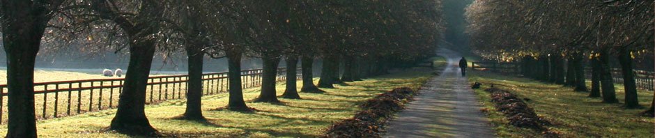
Transportation is a key ingredient. Note that both the Somerville and Charlestown potential growth areas are near (or will be near) subway stations. But subways are not enough. What people want are quiet, comfortable streets full of trees. They want lots of places to run into each other and relax. They want it to be easy to get around by foot or bike, and easy to go elsewhere by subway or bus. They don’t want cars to be banned – cars are wonderful for long trips and ferrying multi-package loads – but they don’t want cars to set the overall design, noise level, smell, or feel of the area. Somerville officials agree that judicious zoning could result in a “new living-center for Somerville, one with homes and business, tall office buildings, quick access to the city, and an ideal location.” (http://www.thesomervillenews.com/archives/17087)
The success or failure of this vision depends in large measure on what happens to the big roads that surround and largely define these areas. There are a lot of people who still feel that cars are vital to their existence and to regional economic growth. There are a lot of developers seeking to preserve, or expand, the value of their investments around the outer rings of the metro area. There will be some local businesses who fear reduced customer access (the Medford Street service road section of McGrath is full of car dealerships!). Some people won’t believe the traffic counts showing reduced volume since the opening of the Zakim Bridge. Some neighborhood people fear that any change in arterial capacity will push drivers on to residential streets, endangering children and seniors and destroying local business and property values – even if methods successfully used elsewhere to prevent these diversions are implemented. And the national political climate seems to reject any public effort to nudge society towards more sustainable, healthy, or socially beneficial behaviors.
The automobile still exerts a powerful influence on our society. And the people who profit from its dominance are still powerful. Nationwide, states used 57 percent of their federal highway funds to build new roads between 2004 and 2008. (See http://www.smartgrowthamerica.org/documents/repair-priorities.pdf). If those same forces maintain their local dominance, McGrath/O’Brien and Rutherford Avenue will be rebuilt as six-lane highways – and business will continue to find it easier to avoid locating in the inner city areas the roads roar through.
On the other hand, there are about 25 separate planning or development processes currently underway along McGrath/O’Brien Highway corridor from Boston’s Leverett Circle through East Cambridge and Somerville to Medford’s Wellington Circle, as well as the Sullivan Square through Rutherford Avenue to City Square stretch in Charlestown. And in nearly every one, the community representatives are pushing for the same general set of goals:
1. Reunite neighborhoods cut apart by the highway — prioritize local connections going across the road rather than traffic going along it, with each segment of the road (Cambridge Street, Somerville Avenue, Medford Street, the “lost neighborhood,” and the Fellsway) designed to enhance the adjoining areas.
2. Humanize the space by lowering traffic speeds, reducing noise and pollution, by narrowing lanes and cutting them to four instead of the current six (or more)
3. Make traveling across and along the corridor safer and more inviting for pedestrians, bicyclists, and bus riders.
4. Add more trees, grass, storm-water drainage, and other green features; creating comfortable and environmentally enhancing public places where people can meet, sit, and talk together.
5. Encourage local retail and job-creating businesses; including crafts-based and green-economy enterprises.
Will this vision set the frame for future development of these roads and the neighboring communities? It won’t be a technical decision-making process – the experts have already agreed that the community vision can be implemented in ways that do not significant impede expected levels of car traffic. But facts seldom decide big issues. This will be a political battle – the group that can mobilize the most political power will win.
At stake is not just the future of the north-or-Boston suburbs. If McGrath/O’Brien and Rutherford Avenue are rebuilt as highways, it is extremely likely that the same thing will happen to the Casey Overpass and all the rest of Route 203, as well as cancelling out any chance to prevent the region’s so-called “parkways” from succumbing to a similar fate.
Every now and then an issue is joined that becomes a turning point. What happens with the former highways north of Boston will shape what happens to communities around the entire region. We need to not only understand the stakes but to also raise our voices and get involved.
————————————————-
Some related previous posts:
